
The short answer
Vancouver → Whistler → Kamloops is one of the best shorter RV road trips in British Columbia. The first section follows Highway 99 north along Howe Sound and the Sea to Sky corridor to Whistler. From Whistler, the route continues through Pemberton and over the more rugged Duffey Lake Road before reaching Lillooet and connecting toward Kamloops.
It is a very different trip from the direct Vancouver-to-Kamloops highway route. You trade speed for scenery: ocean inlets, waterfalls, granite mountains, alpine lakes, ranch country and the dry interior of British Columbia. For most RVers, 3 days is the minimum, while 4 to 5 days gives you time to actually enjoy Whistler, Pemberton and the Highway 99 corridor.
Important RV note: the Vancouver–Whistler section is straightforward by RV, but the road north of Whistler becomes much more mountainous and winding. Do not plan the Whistler–Kamloops leg purely by the distance shown on a map. Check DriveBC, weather, highway advisories and your campground's current operating dates before leaving.
Trip at a glance
| Trip information | Details |
|---|---|
| Route | Vancouver → Squamish → Whistler → Pemberton → Duffey Lake → Lillooet → Kamloops |
| Distance | About 430 km (roughly 270 miles), longer than the direct Coquihalla route |
| Main highway | Highway 99, then Highway 1 approaching Kamloops |
| Recommended time | 4 to 5 days |
| Road character | Paved highway, mountain grades, curves and several narrow or constrained sections north of Whistler |
| Best season | Late spring through early fall for most RV travelers |
| Trip highlights | Howe Sound, Squamish, Brandywine Falls, Whistler, Pemberton, Duffey Lake, Lillooet and Kamloops |
| RV services | Best in Vancouver, Squamish, Whistler, Pemberton, Lillooet and Kamloops; fewer services between towns |
| Cell service | Good around towns, with gaps possible on remote mountain sections |
How the route works
The route has two personalities.
Vancouver to Whistler is the famous Sea to Sky Highway. You travel along the eastern shore of Howe Sound, pass Squamish and continue north through a spectacular mountain corridor. It is busy in summer and around weekends, so an RV should allow time for traffic, viewpoints and campground access.
Whistler to Kamloops is quieter and more remote. Highway 99 continues through Pemberton and then climbs into the Coast Mountains on Duffey Lake Road. The landscape changes dramatically as you approach Lillooet and the dry interior. From there, the route continues east toward Kamloops.
| Day | Route | Overnight idea |
|---|---|---|
| 1 | Vancouver → Squamish → Whistler | Whistler |
| 2 | Whistler and surrounding area | Whistler |
| 3 | Whistler → Pemberton → Duffey Lake → Lillooet | Lillooet area |
| 4 | Lillooet → Cache Creek → Kamloops | Kamloops |
| 5 | Extra Kamloops day or continue east/west | Kamloops or next destination |
Day 1: Vancouver to Squamish
Leaving Vancouver, Highway 99 becomes the Sea to Sky Highway as it heads toward Horseshoe Bay and the Howe Sound corridor. This is the easy part of the trip in terms of navigation, but it can be busy, especially during summer weekends.
Horseshoe Bay and Howe Sound
Horseshoe Bay is a useful reference point because it is where the highway leaves the Vancouver area and begins the scenic climb beside Howe Sound. If you are coming from Vancouver Island, you may already have completed a BC Ferries crossing before starting this guide's route.
For a large RV, do not stop wherever a passenger vehicle can squeeze onto a shoulder. Use signed viewpoints and designated parking areas, and remember that some pullouts are not designed for long trailers.
Squamish
Squamish is one of the most useful service towns on this section. See campgrounds near Squamish if you want to break the day. It is a good place to top up fuel, buy groceries, check your rig and take a break before continuing to Whistler.
The surrounding landscape is dominated by mountains, forest and exposed rock. The Stawamus Chief is the most recognizable landmark, while Shannon Falls is another popular stop. If you are towing, check parking dimensions before turning into any attraction or day-use area.
Whistler by RV
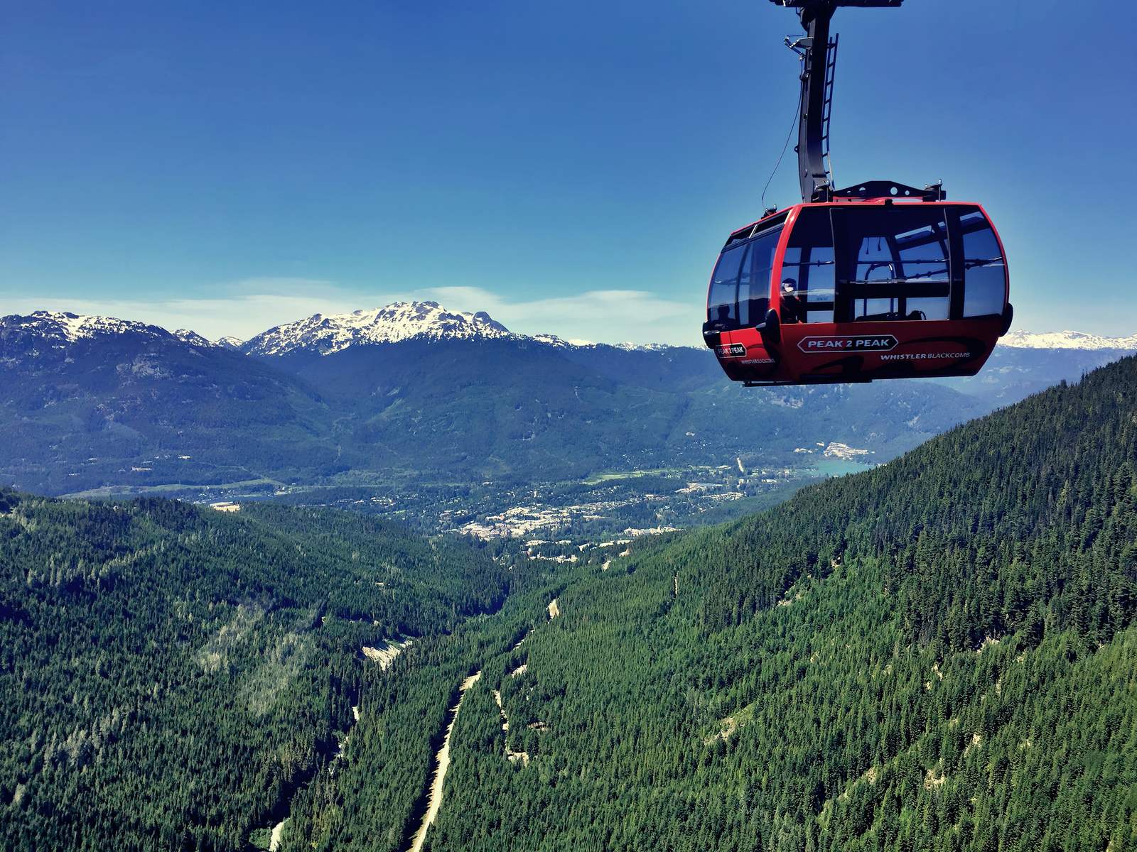
Whistler is worth at least one full day. The village is walkable, and there are enough outdoor activities to fill several days, but RV parking and overnight rules matter.
The Resort Municipality of Whistler says sleeping in your vehicle is not permitted on roads or in parking lots, so plan on a campground each night.
RV camping near Whistler
- Whistler RV Park and Campground: the obvious choice if you want to stay close to Whistler with an RV-oriented campground.
- Riverside Resort: another Whistler-area option listed by the municipality.
- Cal-Cheak Recreation Site: a more rustic option south of Whistler.
- Nairn Falls Provincial Park: about 20 minutes north of Whistler and a useful base for Whistler, Pemberton and the next leg north.
Always check current operating dates, site dimensions, hookup availability and reservation requirements. BC Parks says many frontcountry campgrounds accommodate RVs, but individual parks and sites have their own limits.
What to do in Whistler
- Walk Whistler Village and the pedestrian areas.
- Explore Lost Lake and nearby trails.
- Ride the gondola or spend time in the alpine area if operating conditions permit.
- Visit the Squamish Lil'wat Cultural Centre.
- Use Whistler as a base for mountain biking, hiking, fishing and sightseeing.
If you have a trailer, the best strategy is usually to leave it at the campground and explore with a smaller vehicle, shuttle or other local transportation rather than trying to take the entire rig everywhere.
Day 2 or 3: Whistler to Pemberton
Highway 99 continues north through a dramatic change in scenery. Our fuel planner can help you plan the stops. The mountains remain enormous, but the route begins to feel less like a resort corridor and more like a mountain travel route.
Pemberton is an important RV service stop. It is your last major opportunity around Whistler to organize fuel, food and supplies before the more remote Duffey Lake Road section.
Nairn Falls
Nairn Falls Provincial Park is about 20 minutes north of Whistler and five minutes from Pemberton. BC Parks describes it as a useful base for Whistler, the Pemberton Valley and Garibaldi Park, and specifically notes that it makes a good overnight stop before continuing onto Duffey Lake Road or points north or south.
The falls are reached by a 1.5 km hiking trail. The park sits beside fast-moving water, so follow posted safety guidance and keep children away from steep banks and drop-offs.
Duffey Lake Road: the RV section to respect
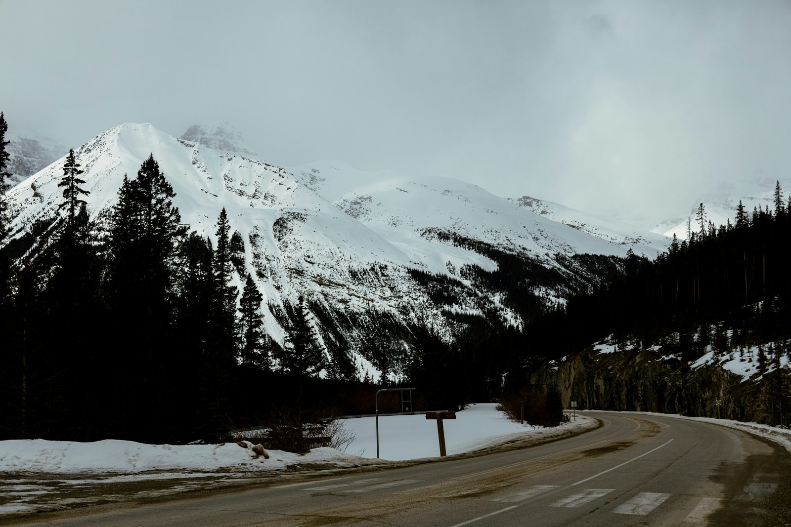
North of Pemberton, the route becomes substantially more demanding for a large RV. Duffey Lake Road is scenic, but it is a mountain road with curves, elevation changes and fewer services. This is the section where you should stop thinking in terms of how quickly a car can make the trip.
Before leaving Pemberton
- Fill the fuel tank or make sure you have enough range for the next planned fuel stop.
- Check tire pressures, trailer brakes, engine fluids and cooling system.
- Secure cabinets and loose interior items.
- Download maps and route information before entering areas with weak cell coverage.
- Check DriveBC for closures, incidents, construction and current road conditions.
Duffey Lake Provincial Park
BC Parks says Duffey Lake Park is about 35 km east of Pemberton and nearly midway to Lillooet. It is a scenic stop for canoeing, kayaking, fishing and wildlife viewing, but it is not a full-service RV campground. Potable drinking water is not available, so carry your own water.
The park has no formal hiking trails, and the boat launch is rough gravel. Treat it as a scenic break rather than assuming it is an easy place to turn a long motorhome and trailer around.
Lillooet: the landscape changes
After the mountain lakes and forests, the road toward Lillooet enters a much drier interior landscape. This is one of the things that makes the route so interesting: you can leave coastal rainforest in the morning and be surrounded by dry grasslands, steep canyon walls and interior valleys later the same day.
Lillooet is a useful place to slow down, refuel and check your RV before continuing. See campgrounds near Lillooet. Depending on your schedule, it can be a good overnight instead of trying to reach Kamloops the same day.
If you are travelling with a trailer, an overnight in Lillooet also gives the tow vehicle and driver a break after the mountain section. That can be a better choice than pushing through simply because the map says Kamloops is still reachable.
Lillooet to Kamloops
From Lillooet, Highway 99 continues through the interior to Cache Creek, where you join Highway 1 for the final stretch into Kamloops. This is where the trip begins to feel less like the Sea to Sky and more like an interior British Columbia road trip.
Kamloops is an excellent end point because it has the services an RV traveler needs: major fuel options, groceries, RV supplies, restaurants, repair services and multiple campground choices.
RV camping near Kamloops
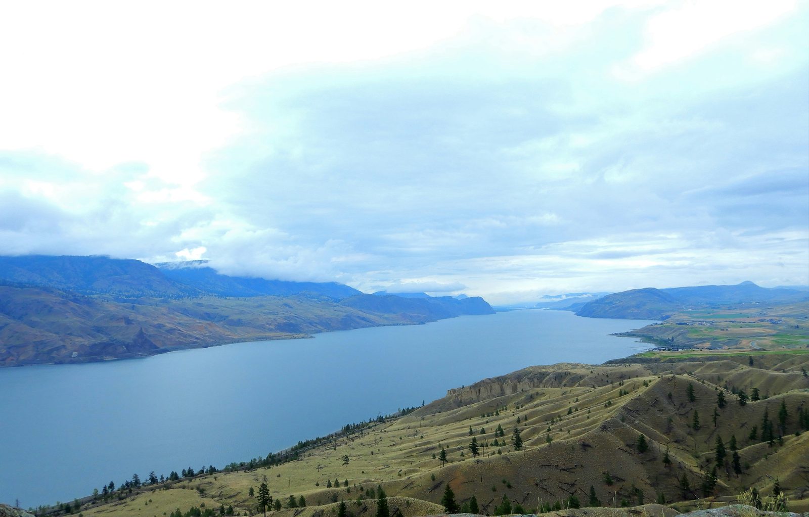
See all campgrounds in Kamloops as well.
Lac Le Jeune Park
Lac Le Jeune Park is one of the strongest BC Parks choices near Kamloops for an RV. It is located 37 km south of Kamloops on Highway 5, with another paved access route from Highway 1. BC Parks lists 21 double vehicle-accessible campsites and says most sites accommodate medium to large recreational units.
The campground is treed and offers privacy, potable water, toilets, swimming, fishing and boating. It also has a user-pay sani-station. BC Parks currently lists both reservations and first-come, first-served camping, subject to operating dates and availability.
Paul Lake Park
Paul Lake Park is another useful choice, about 30 minutes from Kamloops. BC Parks lists 90 vehicle-accessible campsites, reservations plus first-come, first-served camping, and a sani-station with an RV water-fill station.
There are no pull-through sites, so check your rig dimensions before choosing it. The park has a beach, hiking trails, boating and fishing, making it a good place to spend a quiet night rather than simply stopping to sleep.
RV driving tips for this route
1. Do the easy section early
If possible, leave Vancouver early. The Sea to Sky corridor is much more enjoyable when you are not trying to make campground check-in while dealing with peak traffic.
2. Do not rush Duffey Lake Road
This is the single most important driving tip. The road north of Whistler is not the place to maintain a car's pace in a large motorhome or trailer. Use a safe speed for your rig, stay in the correct gear and leave plenty of room for oncoming traffic.
3. Control speed before the descent
Do not wait until you are already descending to decide how you will control speed. Select the appropriate lower gear before the slope becomes steep. Use engine braking where appropriate and apply service brakes deliberately rather than continuously riding them.
4. Watch the weather
Mountain weather can change quickly. Rain, fog, snow, wind and wet pavement can all make an RV more difficult to control. Check current conditions rather than relying on a forecast you looked at several days earlier.
5. Expect wildlife
Forested mountain roads are wildlife corridors. Slow down when visibility is limited, especially around dawn and dusk, and never stop in an unsafe location simply because you see an animal.
Is this route suitable for a large RV?
Yes, but your campground and parking choices may be more restrictive than the highway itself. Highway 99 is a major route, but not every viewpoint, campground road, recreation site or town parking lot is designed for a 40-foot-plus motorhome with a tow vehicle.
Before booking, check:
- Maximum site length and driveway length.
- Whether the site is pull-through or back-in.
- Turning space.
- Maximum vehicle height or width where posted.
- Whether your trailer can be left connected.
- Whether the campground road has tight turns or steep approaches.
For a large fifth wheel or Class A, established RV parks in Whistler and larger campground sites near Kamloops are the safer choices. Treat smaller recreation sites as optional stops rather than guaranteed overnights. Our big-rig-friendly campgrounds list is a good place to start.
Fuel, groceries, propane and RV services
The safest strategy is to treat the trip as a series of service zones rather than assuming fuel is available everywhere.
| Area | RV planning use |
|---|---|
| Vancouver | Start with full fuel, groceries and water. |
| Squamish | Fuel, groceries and a good pre-Whistler service stop. |
| Whistler | Campground base, food, fuel and supplies. |
| Pemberton | Important resupply stop before Duffey Lake Road. |
| Lillooet | Fuel, food and an optional overnight. |
| Kamloops | Major resupply, RV services, fuel and campground hub. |
Cell service and navigation
Do not assume you will have continuous cell service between Whistler and Kamloops. Download offline maps before leaving Whistler or Pemberton, save campground addresses and keep a paper or offline backup of the route.
DriveBC is the key road-information source for British Columbia. Its system provides highway conditions, closures, incidents, cameras, weather information and other travel information. Check it immediately before starting the Duffey Lake section.
Best time to drive Vancouver to Whistler to Kamloops
June
June can be excellent for long daylight hours and mountain scenery. Check campground operating dates and higher-elevation weather carefully.
July and August
These are the busiest months. Expect more traffic around Vancouver, Squamish and Whistler, and reserve popular campgrounds early. The advantage is that most visitor services are operating.
September
September can be one of the best compromises for an RV trip: fewer crowds than peak summer and excellent scenery. Check individual campground closing dates.
October through spring
This becomes a weather-dependent mountain trip. BC Parks operating dates vary, and winter conditions can affect Highway 99. If you travel outside the normal RV season, check DriveBC and current park advisories immediately before departure.
A practical 3-day itinerary
| Day | Plan |
|---|---|
| 1 | Vancouver → Whistler. Stop around Squamish, continue to Whistler and settle into your campground. Evening in the village. |
| 2 | Whistler → Pemberton → Duffey Lake → Lillooet. Leave early, enjoy the viewpoints and make Lillooet the overnight goal. |
| 3 | Lillooet → Kamloops. Continue through the interior and arrive in Kamloops with time for fuel, groceries and a campground. |
This works, but it is a road-trip itinerary rather than a vacation. If Whistler is a major part of your trip, add a day.
A better 5-day itinerary
| Day | Plan |
|---|---|
| 1 | Vancouver to Whistler via Squamish. Camp in Whistler. |
| 2 | Full Whistler day. Leave the RV at the campground when practical. |
| 3 | Whistler to Pemberton, Duffey Lake and Lillooet. Overnight in Lillooet. |
| 4 | Lillooet to Kamloops. Settle into a campground such as Lac Le Jeune or Paul Lake. |
| 5 | Full Kamloops-area day, or continue to your next destination. |
RV checklist before leaving Whistler
- Fuel topped up
- Fresh-water tank checked
- Propane checked
- Tire pressures checked cold
- Trailer brakes and breakaway cable checked
- Mirrors/cameras adjusted
- Cabinets and refrigerator secured
- Offline maps downloaded
- DriveBC conditions checked
- Campground reservation or arrival plan confirmed
- Food and drinking water sufficient for the remote section
More route guides: Vancouver to Kelowna by RV, Vancouver to Calgary by RV, Calgary to Vancouver by RV, Taking an RV on a BC Ferry and Vancouver to Tofino by RV.
Frequently asked questions
Can you drive from Vancouver to Whistler in an RV?
Yes. Highway 99 is the main Sea to Sky route and is used by RVs, although mountain grades, traffic, curves and limited stopping areas require extra planning.
How far is Vancouver to Whistler by RV?
The route is roughly 120 km, but an RV trip should allow much more time than the driving distance suggests because there are scenic stops, traffic and mountain-road conditions.
Can you drive an RV from Whistler to Kamloops?
Yes. The usual route is Highway 99 through Pemberton, Duffey Lake and Lillooet to Cache Creek, then Highway 1 into Kamloops.
Is the road from Whistler to Lillooet difficult for an RV?
It is more demanding than the Vancouver–Whistler section. Duffey Lake Road is mountainous and winding, so larger rigs should take the route slowly, use lower gears on descents and check current conditions before leaving.
Where can RVs camp near Whistler?
Options in the Whistler area include Whistler RV Park and Campground, Riverside Resort, Cal-Cheak Recreation Site and Nairn Falls Provincial Park. The Resort Municipality of Whistler says sleeping in a vehicle is not permitted on roads or in parking lots.
Can I camp at Duffey Lake Provincial Park?
Duffey Lake Park is a scenic stop along Highway 99, not a full-service RV campground. BC Parks says potable water is not available, so carry your own drinking water.
Is Joffre Lakes a good RV stop?
Joffre Lakes is a very popular destination, but its parking and access require planning. The park's campground is backcountry only and requires reservations, so it should not be treated as an easy RV overnight.
Where should I camp near Kamloops?
Lac Le Jeune Park and Paul Lake Park are two BC Parks options near Kamloops. Lac Le Jeune has vehicle-accessible sites that accommodate many medium to large RVs and a sani-station; Paul Lake has 90 vehicle-accessible sites and a sani-station.
How many days should this RV trip take?
Three days works for a road-focused trip. Four to five days is better if you want time in Whistler, Pemberton and the lakes and viewpoints along Highway 99.
When is the best time to drive this route?
Late spring through early fall is the easiest season for most RVers. Summer has the fullest services but also the most visitors. Shoulder-season travel requires closer attention to weather, campground operating dates and road conditions.
Official sources
Road conditions, campground dates, fees and access rules change. Check these before travel.